$322.91 Down, Build & Relax Here
2001 N 57th Terrace : Kansas City, KS 66104
Wyandotte County, Kansas
Lot Description
$322.91 Down, $322.91/Mo for 36 Months, 0% Int.
No Credit Checks. All Major Credit Cards Are Accepted.
Call or Text Us Now To Reserve.
30-Day Money Back Guaranteed.
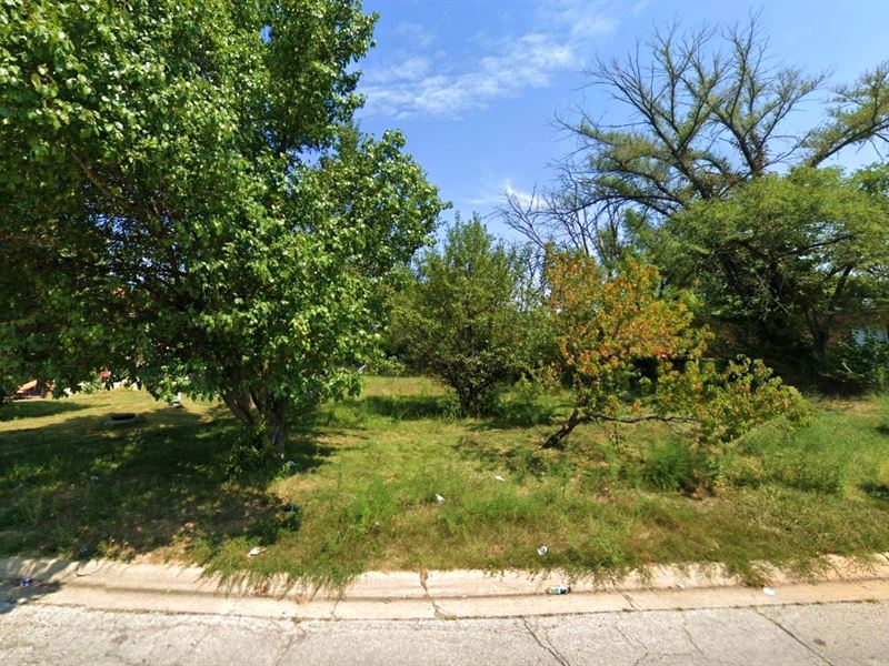
Introducing a prime piece of vacant land located in the vibrant city of Kansas City, KS. This property boasts an expansive lot size of 0.20 acre, providing ample space for a wide range of possibilities. Situated in a thriving and up-and-coming area, this versatile land offers endless possibilities, perfect for both residential development and recreational purposes.
Property Address: 2001 N 57th Terrace, Kansas City, KS 66104
Lot Size: 0.20 Acre
Zoning: Residential and Recreational Use
Electricity: YES - Power Lines are There
Primary Road: Paved Road Access
Water: YES - Water Service is Available in the Area
Make Your Move, Reserve It Now For Only $322.91. Act Now On This Sought-After Lot While You Can. Get Easy 36 Months Financing at 0% Interest, No Credit Checks, All Major Credit Cards Are Accepted.
Cheap and Affordable Vacant Land For Sale in Kansas City
Flexible Financing Options are Available
Owner Financed Urban Land in Kansas
Undeveloped Property For Sale With Direct Road Access
For Residential Development in Wyandotte County
Buildable Land With Water And Power Access
Homesite Potential With Scenic Views
Single-Family Homes, Municipal Facilities, and Community Centers are Permitted
Permitted Uses include Agricultural Uses That Do Not Involve Animals or Livestock
Finance Land Near Entertainment Hubs
Perfect for Hunting and Fishing Enthusiasts, Being Close to Recreational Centers
Quiet and Friendly Neighborhood
Located Near Golf Course, Schools, Parks, Shops, and Restaurants
Not in Flood Zone and Wetlands
Property Within Secured Subdivision
Lot Maps & Attachments
Directions to Lot
Center of Lot GPS Coordinates: 39.128974, -94.712317
GPS Coordinates for Corners of the Property:
Nw: 39.129207, -94.712342
Ne: 39.129043, -94.712177
Se: 39.128807, -94.712179
Sw1: 39.128825, -94.712354
Sw2: 39.128865, -94.712508
More Lot Details
Lot Price History
More Lots from Patrick Elder
 19.1 AC : $699K
- 7.5 AC : $40K
- 10 AC : $19K
- 8.9 AC : $16K
- 2.5 AC : $14.5K
- 1 AC : $20K
- 0.7 AC : $24K
- 6 AC : $25K
- 2.5 AC : $29K
- 4.9 AC : $20K
- 1.1 AC : $9.5K
- 2.6 AC : $12K