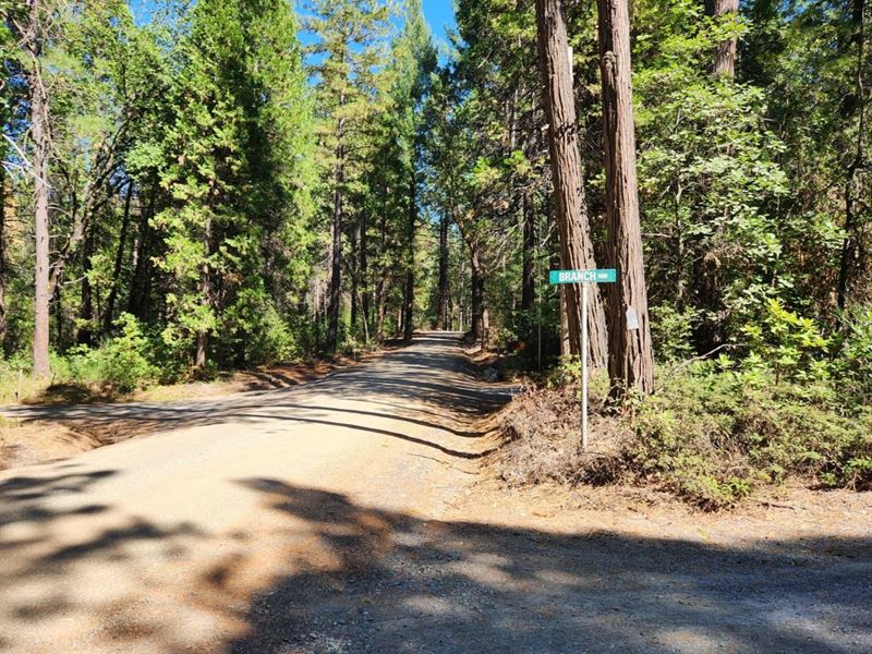
Mountain Frontier Georgetown, CA
Grey Eagle Rd : Georgetown, CA 95634
El Dorado County, California
Lot Description
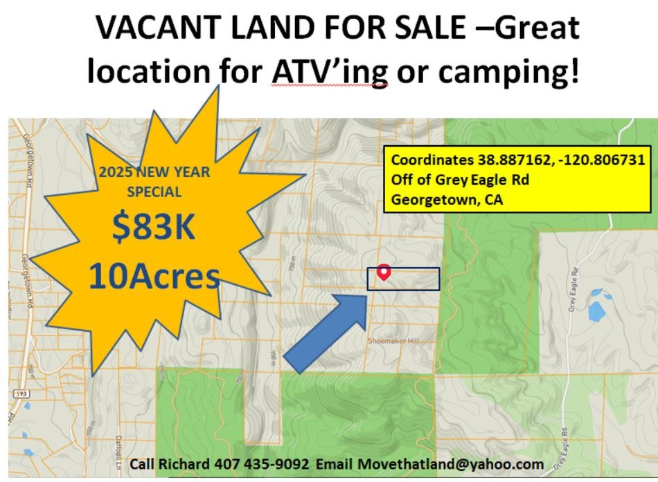
Embrace the Outdoor in Georgetown, CA 10 Acres - $73,000
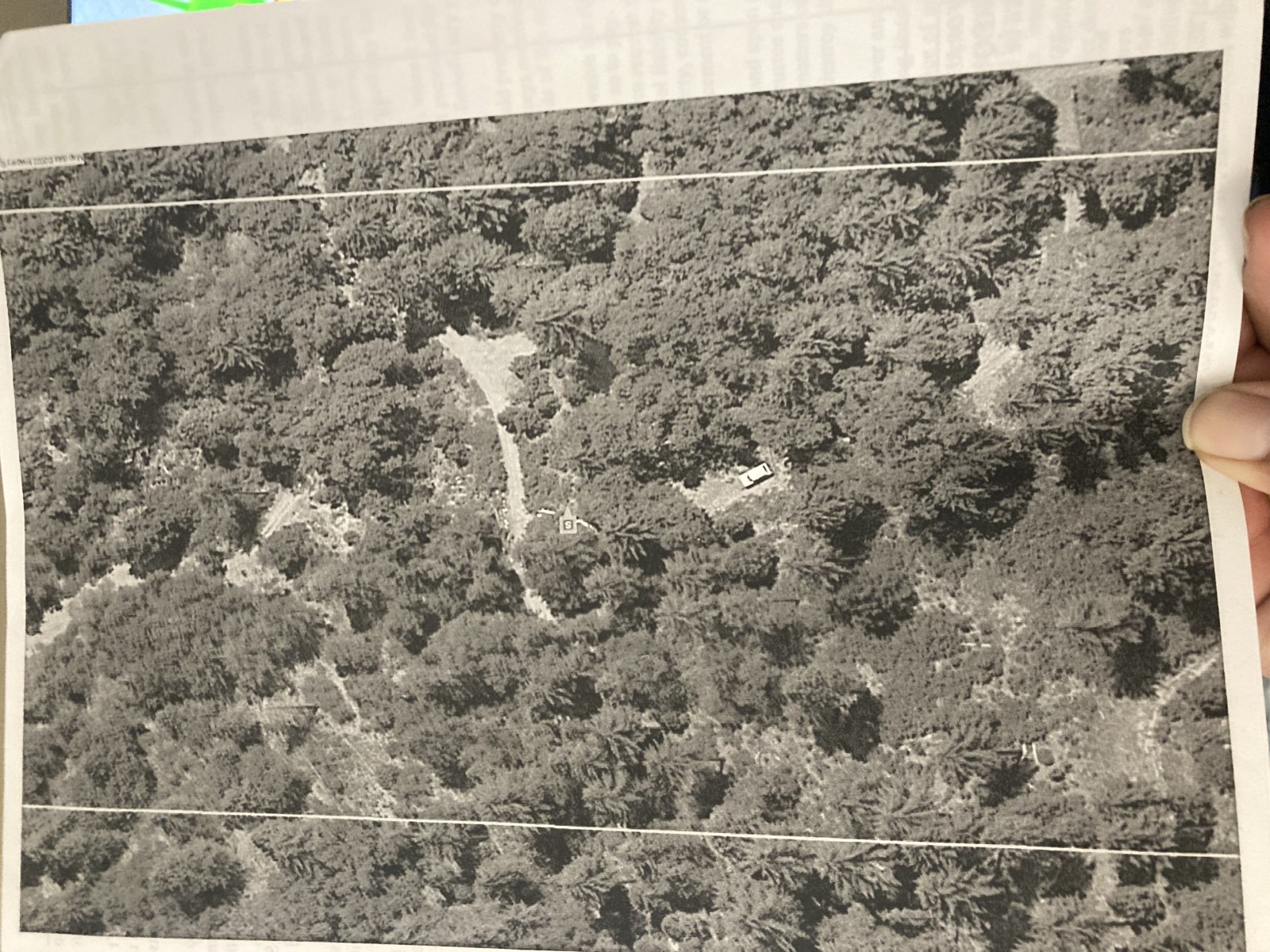
Discover the ultimate retreat for nature lovers with this buildable lot tucked into the heart of El Dorado National Forest. Surrounded by 360° views of towering trees, majestic mountains, and a babbling creek, this property is a true sanctuary for outdoor enthusiasts.
Immerse yourself in the beauty of the wild-explore endless trails, relax by the water, or simply enjoy the peace that only nature can provide. Whether you're looking for adventure or a serene escape, this land is your blank canvas.
Get your 4x4 ready for rugged exploration, and let this peaceful haven be your gateway to the great outdoors. Invest in your dream today.
Property Highlights: 10-Acre Vacant Land in Georgetown, Ca
• Zoning: 8001 Residential - Ready for your dream home or weekend getaway
• Access: Via Eagle Rd or Ca-193 for convenient entry
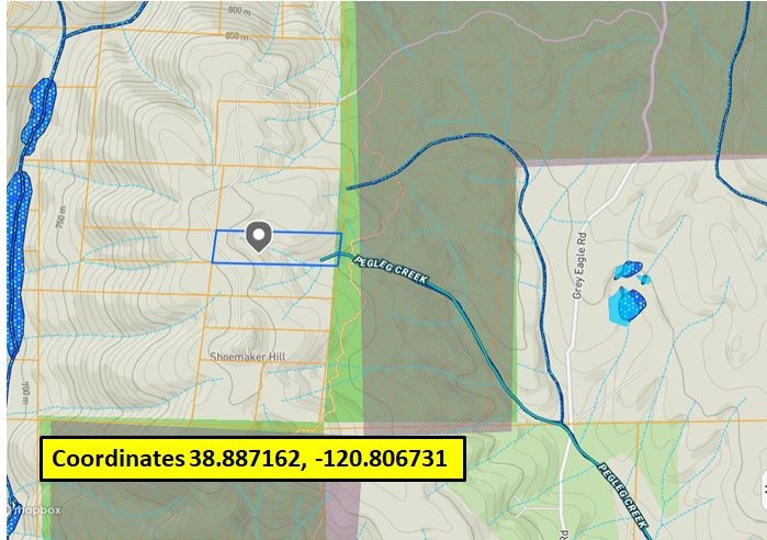
• Natural Feature: Pegleg Creek meanders through the eastern property line
• Recreation: Ideal for ATV adventures or weekend camping trips
• Stargazing: Prime location with clear night skies, far from city light pollution
• Proximity: Just 43 miles from Sacramento for a quick nature escape
• Surroundings: Adjacent to El Dorado National Forest for endless outdoor exploration
• Freedom: No Hoa, giving you complete control over your land
• Terrain: Elevated land as part of Shoemaker Hill for sweeping views
• Utilities: No existing electric or well-perfect for off-grid living or customization
• Trails: Mar Det Trail runs along the eastern edge for hiking and exploring
This property is a nature lover's dream, offering peace, privacy, and endless adventure opportunities.
Coordinates: 38.887162, -120.806731
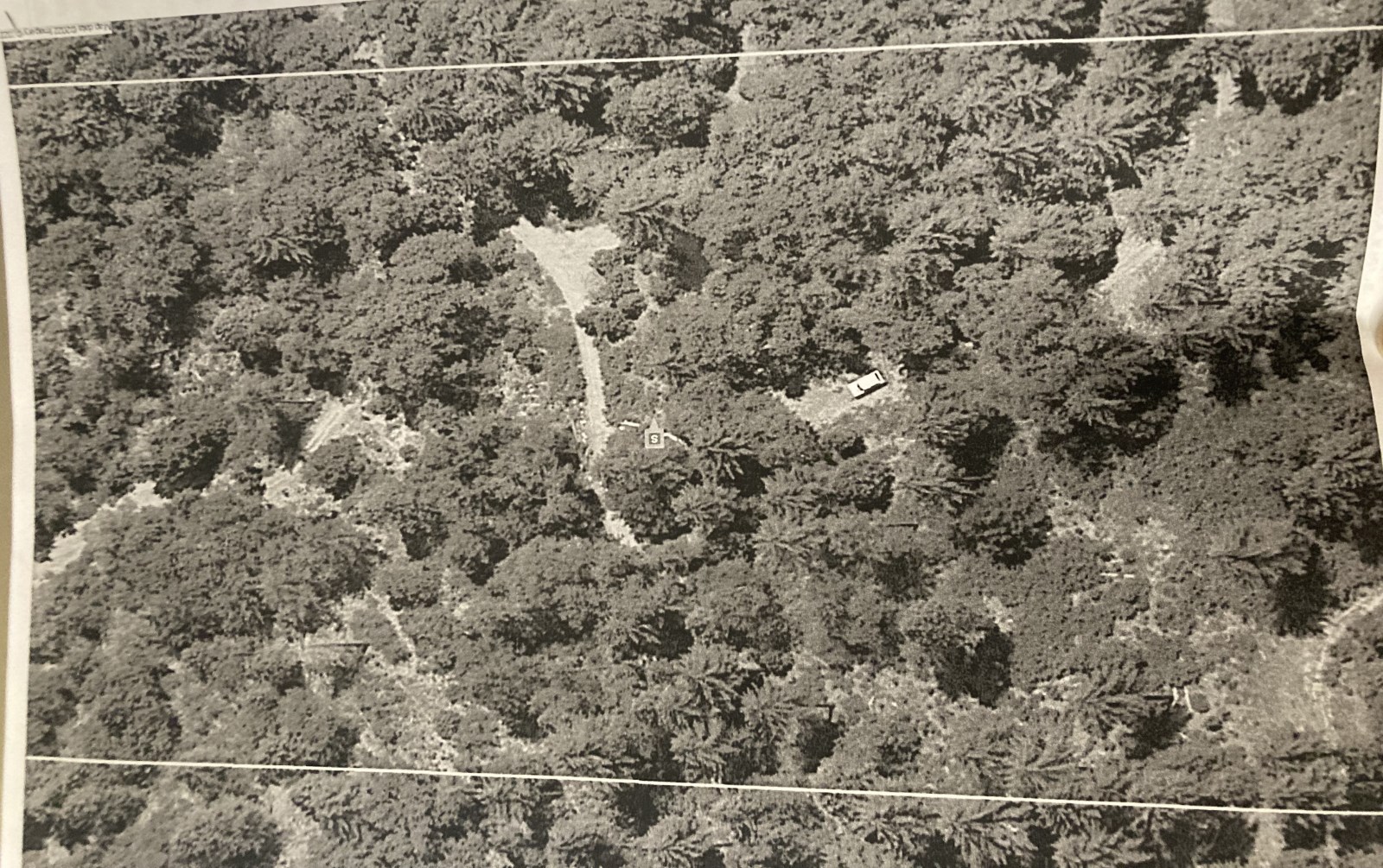
Lot Maps & Attachments
Directions to Lot
Recommended to drive with 4WD Truck or Jeep.
Drive along CA 193 towards Georgetown, CA and head towards Buckeye, (Wentworth Springs Rd).
Head east along Wentworth Springs Rd; passing Georgetown Ranger Station; travel 0.87miles.
Turn right Balderston Rd; drive pass Lion Alley until arriving at Chestnut.
Get on Chestnut and take a left to follow Chestnut Hill Rd; Travel southbound for about 1.34 miles to reach Grey Eagle Rd.
Turn right on Grey Eagle Rd heading southbound, pass Peg Leg Mine Rd( right side). After 600 feet, turn right to continue onto Grey Eagle Rd heading westbound.
Travel 0.4 miles and pass Hotchkiss Hill Rd. continue travelling another 0.3miles and turn right onto Shoemaker Hill Rd.
Continue to travel along Shoemaker Hill Rd for about 1.3 miles and property will be on the left at approx. coordinates 38.887162, -120.806731


